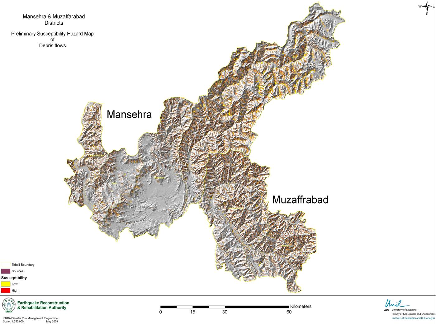
ERRAs Disaster Risk Management Programme (DRMP)
aims at provision of decision support tools
(hazard & risk maps) to government planning
institutions, skill development of community
volunteers and government officials in basic
disaster risk management and adoption of
disaster risk reduction in development.
These maps are the indispensable tools for
multi-sectors to ensure risk conscious
development. These maps provide information
regarding the most common and frequent hazards
and exposures (built environment) in the
entire pilot districts.
Debris Flow
Snow avalanche
Slope instability
Possible Valley Blockage Map (remote hazard)
Flood mapping
Exposure data capturing in progress and
simplified physical risk map being developed